Northern Entrance and Drawbridge:
The entrances to the fortified fort of Kotte was thru a few passes guarded by bastions. The main one was situated on the northern tip of the fortress of Kotte and gave entrance to the road to Colombo. This pass was known as the pass of Ambalama, and was fortified by a bastion and a draw bridge.
The remains of the ancient draw bridge, could be still seen within the Lions Activity Center which is situated next to the first bridge you encounter when you cross from Rajagiriya towards Kotte. This drawbridge was situated outside of the fort and was used to cross the river on the path towards Colombo. The stone remains can be seen immediately in front of the activity center and by the river.
 |
 |
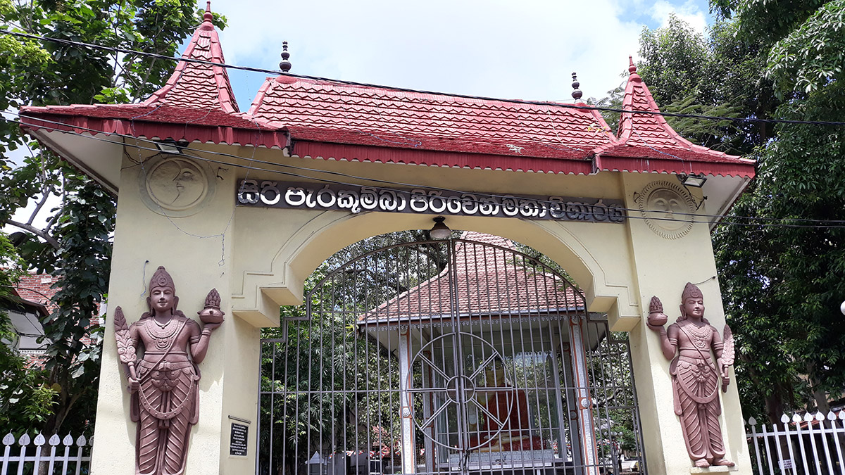
Perakumba Pirivena:
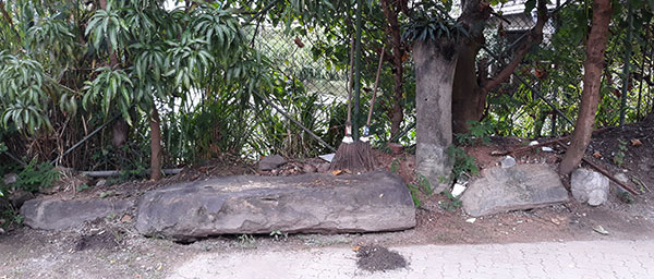
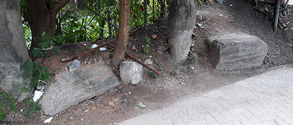
This historic temple found near the turnoff/entrance to Atul Kotte houses parts of the ramparts and a well belonging to the Kotte period, within its premises. The lane leading to the temple could be found immediately to your left, on turning in to the Kotte Road. The remains are found at the bottom of the temple premises. You can also enter from the Jayawardenapura Road, opposite the Diyatha Bus stand (see image below).
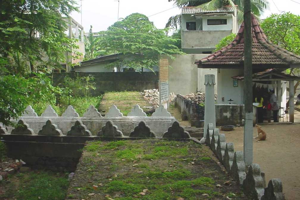
Parts of the ramparts and moat are visible within the premises of this Pirivena. As shown above in the photograph, the ramparts ends with the temple wall, the rest destroyed by the people to build houses and shops.
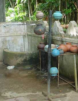
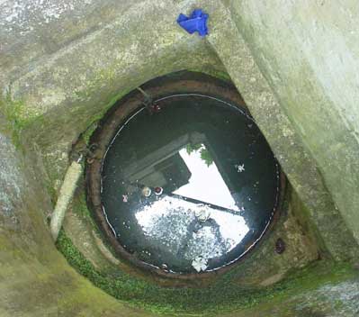
Also preserved is a unique well dating back to the Kotte period. This is now enclosed with a protective wall. The well is lined with clay rings typical of wells built during this period, and has a decorative ring at the top. A similar well dug out by contactors who were building an extension at the Kotte Telecommunications Center has been handed over to the Kotte Archeological Museum and is now displayed there.
The pictures below show the well as it was in 2002, enclosed by a protective wall, and a close up of the well. Note the clay ring found at the mouth of the well. similar rings extend all the way to the bottom.
 |
 |
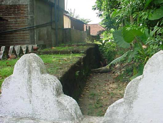 |
| Well with protective wall. | The well with the clay rings | Remains of the Ramparts within the Pirivena. |
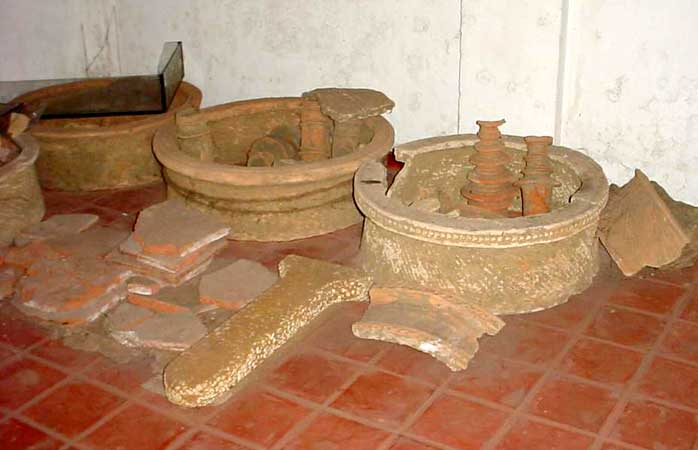
Recently excavated remains of a similar well dating back to the Kotte period, and now found in the Kotte Museum.
The north entrance to the fortified city was also sited close to the Pirivena. The northern entrance facing Konthaganthota was used to ferry in all the supplies thru the Konthagan Thotupala from the Kelani River. The ferry point has been located in close proximity to the present day bridge that crosses over the Diyawanna Oya, around the area now occupied by the Ceylon Electricity Board office.
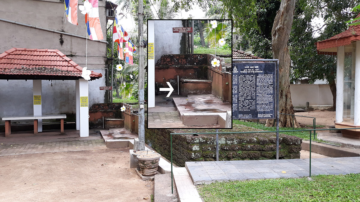
UPDATE 2018:
The well described above has now been completely closed up by the temple. The below picture depicts it as it is today (2018). Inset a closeup of the well.
Location Map – (No 1):