‘K’ is for Kalutara :
From the evidence collected so far it seems that the De Fonsekas and one branch of the D’Anderado family settled in Kalutara North, while the Lowe, De Rowel, Thamel and Tissera families settled in an around Kammala, an area stretching from Negombo to Chilaw, but were mostly concentrated around Marawila, a town halfway between these two.
One branch of the D’anderado family settled in Jaffna, but no details are available of their descendants. Don Manuel D’anderado also was resident in Jaffna as Sabandaar after the siege and capture of the fort by the Dutch in 1658. The other properties of the families were mainly in Colombo.
The connection between Manuel d’Anderado and Kalutara in 1656, identified in the ancestry page could be the earliest link made between a De Fonseka and Kalutara. As it is seen, Manuel d’ Anderado was guarding the Pass at Kalutara, the pass most probably a reference to the river crossing at Kalutara. Don Michael De Fonseka (1658), married his daughter Dominga d’Anderado.
‘Diyambetalawa’ was the Singhalese name given to the islet found near the mouth of the ‘Kalu Ganga’, in Kalutara. This island which now connects the two bridges that span the river was granted by the Dutch to Peduru de Fonseka, on or around 1760. Part of the islet was acquired to build the road and railway bridges, and part of it is now used as a vehicle park for the large number of pilgrims that visit the Kalutara Temple.
The association of this islet with the de Fonseka families, is documented elsewhere under the heading ‘Island in the Stream‘. Here we look at some of the early prints done by Dutch artists of the Kalutara fort and it’s environs including the little island in the river. These pictures gives us a glimpse into the past of Kalutara as well as this beautiful Island.
Early Prints:
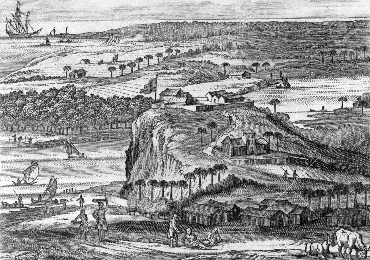
The earliest print that we can find of Kalutara is an engraving done by Baldaeus and found in his book ‘Description of the Isle of Ceylon’ (see the Reference Pages). This engraving done in 1672 shows the fort during the Portuguese times. The islet is shown in the right middle corner of the picture. As described in his book, Baldaeus personally knew both Don Manuel D’anderado and Don Michael de Fonseka while in Jaffna (around 1658). The land shown across the river immediately behind the Fort, also belonged to the de Fonseka and D’anderado families.
The two prints reproduced next are watercolors done during the Dutch times and found in the Rijksmuseum in Amsterdam. Both prints have been taken from the book ‘Illustrations and Views of Dutch Ceylon’ by R. K. de Silva and W. G. M. Beumer, and has been reproduced with the kind permission of Dr. R. K. de Silva. Both the views are to the south, looking across the river, at the ‘Fortress of Kalutara’.
The first of these have been done by C. Steiger and is dated 1710. This shows part of the islet in the lower right corner of the print. Across the river the drawing shows the small hill around which the fort is built.
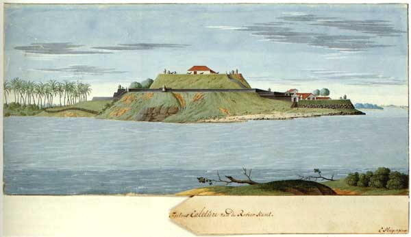
‘The fortress of Kalutara from the river side’, Watercolor, C. Steiger, c.1710, Rijksmuseum, Amsterdam.
The next drawing, discovered recently shows a view very similar to Steiger’s. The island is shown fully in this print, including boats on the river, which makes it more interesting. This undated print from an unknown artist, has been dated by the authors of the book to around 1735, taking into consideration the presence of the bell tower (which is not shown in other drawings of about 1735), and several large trees now shown growing in the compound.
Documentation available do not give us the exact date of the grant of this island, however it can be safely assumed that the grant may have been given subsequent to the appointment of Peduru de Fonseka as Mohandiram of Kalutara and Interpreter to the Opperhooft, on the 21st of January, 1760. The most important evidence available with the family has been a copy of a release by Government dated 20 June 1811 to Bastian De Fonseka, son of Peduru de Fonseka, of the dues of an islet in the Kalu Ganga called Diyambetalawatte, acquired by the British to build the bridge. This document which was with Mudaliyar S. R. de Fonseka, has been handed over to the Historical Manuscript Commission.
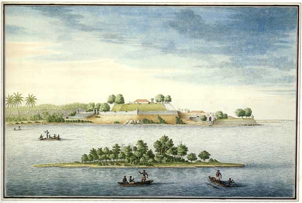
‘Veiw across Kalu Ganga’, Watercolor, unknown artist, Rijksmuseum, Amsterdam.
The land occupied by the fort in the above prints as well as the islet, is now part of the Kalutara Temple Complex.
Kalutara Temple :
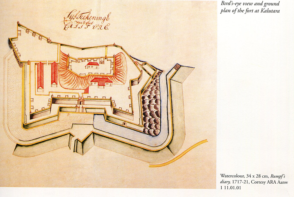
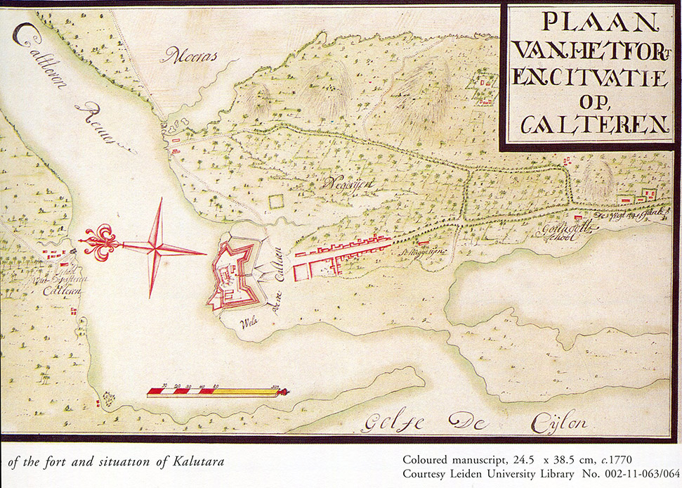
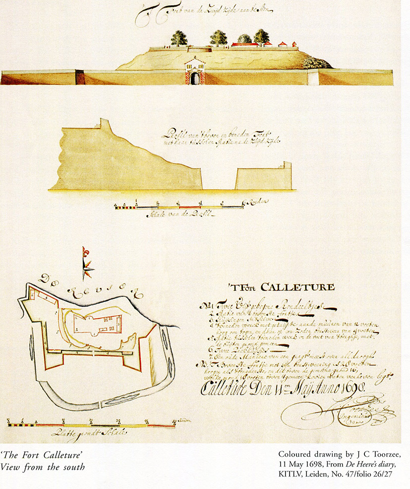
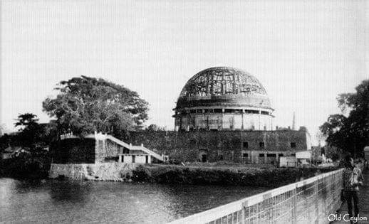 The Kalutara Temple has it’s own interesting history. Long years ago this piece of land on the southern bank of the river was the home to the ‘Gangatilake Viharaya’. The Portuguese realizing the importance of the location, demolished the temple and erected a Fort, to guard the coast and access to the interior along the river artery (as shown by Baldaeus). The Fort was rebuilt and expanded by the Dutch (as illustrated in the above prints), but was surrendered to the British in 1796 who occupied it till Kandy fell in 1815. It then fell into disuse.
Years later the temple was rebuilt on this spot. Around the turn of the century a new residence was also built for the Government Agent, on the little hill shown in the above print. With the laying of the railway line to the south of the country, the rebuilt temple again came under a threat of destruction. Engineers who designed the new rail bridge around 1910 selected a part of ‘Diyambetalawa’ that was best suited for building a bridge, but which sent the line crossing straight into the temple property. After much agitation from the people and representations to the Queen of England, the path of the line was changed further west to avoid demolition of the temple or the sacred Bo Tree. Even today the main rode and the railway line straddles the two sides of the Bo tree. In the 1960’s the premises was been taken over by the Kalutara Bodhi Trust, that once again erected a beautiful Dagoba.
Reference:
Description of the Isle of Ceylon – Baldaeus
Illustrations and Views of Dutch Ceylon’ – Dr. R. K. de Silva and W. G. M. Beumer.
(with thanks to Dr. Rajpal de Silva for permission to reproduce the above prints).