Virtual tour of Kotte – Drawbridge and Perakumba Pirivena
Northern Entrance and Drawbridge: The entrances to the fortified fort of Kotte was thru a few passes guarded by bastions. The main one

Virtual tour of Kotte – The Palace
Traveling down Kotte Road, the next left turn leads one down the Palace (Maligawa) Road. Unfortunately the name board you find at
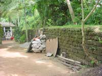
Virtual tour of Kotte – Alakeshwara Road
The present day Alakeshwara road leads one to the remains of what is known as the ruins of the Alakeswara Palace. To
Virtual tour of Kotte – The Ramparts & Inner Moat
The Rampart road a little further down Kotte Road, thankfully leads you to some remains of the great rampart, and the southern
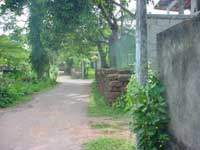
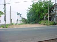
Virtual tour of Kotte – Angampitiya Road
Crossing the Kotte road across from Rampart Road, will lead you to Angampitiya Road. Towards the end of this road you will
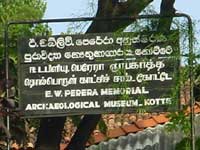
Virtual tour of Kotte – Kotte Archeological Museum
By the side of the Kotte Road, just beyond Angampitiya Road, is the E. W. Perera Archeological Museum – Kotte. This is
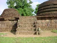
Virtual tour of Kotte – Weherakanda
The best-preserved of the remains of Kotte could be found at Weherakanda in beddegana. This has been situated outside and to the
Virtual tour of Kotte – The Outer Moat and the Southern Entrance
Outer Moat – Eastern side adjoining Sri Kotha Outer Moat – Western side Outer Moat – Close up of western side The

Virtual tour of Kotte – The Tunnels of Kotte
The cave & tunnel complex, now barricaded. A side view of the complex A closeup view These photographs shows what is known
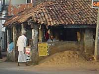
Virtual tour of Kotte – Others
The Gal Ambalama: Nameboard equating the Ambalama with a British Doss-House Details of the Ambalama Roof and support columns Frontal view of
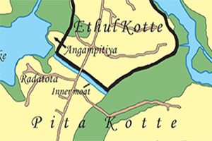
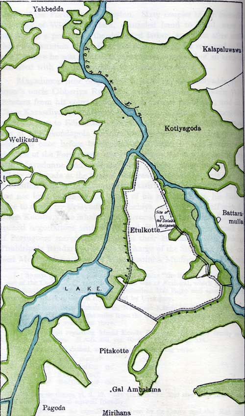
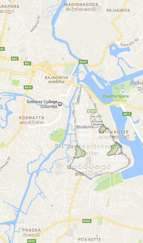
Virtual Tour of Kotte – Maps then and now
This page compares a map of Kotte found in Wikipedia and other articles, showing the structure of the fortress, with the Palace, roads